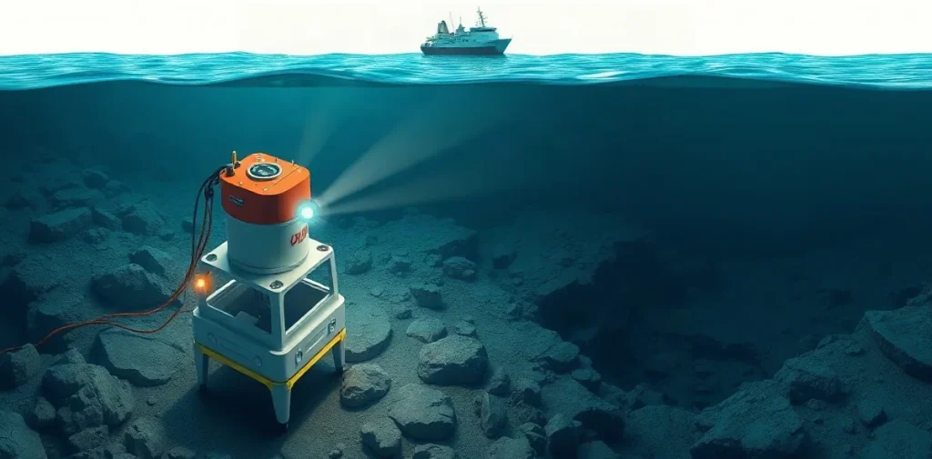
Remotely operated vehicles (ROVs) let researchers examine and map underwater geology from a surface-controlled platform. In places such as Monterey Bay, they can bring cameras and instruments close to the seafloor, helping scientists connect visible terrain with geological processes while limiting the need for people to work at depth.
What does geological mapping underwater investigate?
Geological mapping describes the shape and materials of the seabed and the features that interrupt it. Researchers may examine rock outcrops, sediment, slopes, channels, fractures and boundaries between different seafloor surfaces. Together, these observations help build a picture of how an underwater landscape formed and how it changes.
At sea, visibility is limited, direct access is difficult, and a view from above cannot always distinguish one seabed type from another. A vehicle travelling near the bottom can collect close-range observations across an area, linking individual features to their position and surrounding terrain.
How can an ROV turn observations into a map?
An ROV is operated from a support vessel, usually through a tether that carries control and communications. Its cameras provide a live view; other equipment may include lights, navigation sensors or tools for examining the seabed. The vehicle’s route and altitude affect what it can see, so careful, repeatable coverage matters as much as the instrument package.
Mapping combines observations with location and depth information. Researchers interpret imagery alongside navigation data and, where appropriate, samples or measurements collected by other methods. A camera image can reveal texture and shape, but it does not automatically identify a rock or establish the full extent of a feature.
- Position: where each observation lies in relation to the survey route and surrounding seabed.
- Altitude and viewing angle: how close the vehicle is to the bottom and which features the camera can resolve.
- Ground truth: direct observations or samples used to check interpretations of remotely collected data.
- Coverage: whether the survey has examined enough of the area to describe its boundaries and variation.
Why use a vehicle instead of sending divers?
Human divers can make close observations and use their senses and judgement to respond to a scene. But depth, bottom time, gas supply, decompression obligations, cold, current and visibility constrain what a dive team can do. An ROV can remain underwater without exposing an operator to pressure, and it can carry cameras into environments that would be difficult or unsuitable for routine diver access.
That does not make vehicles a substitute for every scientific dive. Divers may be better suited to delicate sampling, tasks requiring manual dexterity, or observations that depend on a person moving freely through a site. The choice depends on the question, the depth and conditions, the required precision, and the risks of the operation.
What can the method tell divers about a site?
Seafloor maps can help scientific divers plan where to work, identify potential hazards and understand the terrain around a sampling location. A mapped slope, loose sediment or rocky outcrop can affect access, visibility and the way a team moves or handles equipment. Geological context can also help explain why a site has particular habitats or changes over time.
For diving operations, a map is a planning aid rather than a guarantee of conditions on the day. Currents, suspended sediment, marine growth and local visibility can change what a diver or camera can see. You still need a site-specific assessment and a plan appropriate to the dive team and conditions.
How does seafloor mapping fit into diving science?
Underwater mapping sits at the intersection of marine geology, ocean technology and scientific diving. It shares a practical concern with diving medicine: how to gather useful information underwater while managing exposure and operational risk. ROVs shift some of the work from a person in the water to a remotely operated system, but the survey still depends on sound planning, reliable observations and careful interpretation.
For clinicians and scientific-diving teams, the distinction between human and vehicle operations matters. An ROV operator is not exposed to underwater pressure through the vehicle, while divers remain subject to the physiological demands of immersion and depth. When a project combines both approaches, each task needs its own equipment, personnel and safety plan.
Frequently asked questions
What is an ROV?
Can an ROV replace scientific divers?
Does an ROV map show exactly what a diver will encounter?
An original research-library explainer written by the Rubicon editors. It is not a summary of a specific publication.